That's Moab
“There is much to see”
Abigail Edwards
The Arches National Monument Scientific Expedition
Frank A. Beckwith
In the winter of 1933 and spring of 1934, an expedition, led by
Frank Beckwith of Delta Utah, conducted a reconnaissance survey for
the Department of the Interior to inventory and assay the natural
and scientific resources found within and nearby the recently
established Arches National Monument. While the scenerey had been
popularized by writers and photographers who had explored the
region, few details were actually known about the landscape due to
the inhospitable desert conditions, and the abscence of comfortable
transportation.
The following is content transcribed from the official report sent
by Mr. Beckwith to his clients in Washington D.C.
preface page 1
ARCHES NATIONAL MONUMENT
March 1934 Report of the Arches National Monument Scientific Expedition for the month ending March 29, 1934.
By Mr. Frank Beckwith, Leader
"During the month of March, Geologist J. C. Anderson finished his
work at the Arches Sector of the Monument; he has given that much
detail and is prepared to furnish a plane table map with each major
object located; he has correlated the stratigraphy of the region
with known and named stratigraphy, and carried it into · that area
with care; he will give sections and such other information in
detail as to that portion of the Monument which is expected in a
geologic report.
"He has visited the Yellow Cat area twice and finished that area.
The Yellow Cat area will not be gone into in as much detail as the
Arches sector but it will be given in sufficient detail to cover it
scientifically. The beds there differ from the others in respect
that they suffer no tilting, lie horizontally, and embody sandstone
layers and Morrison shale. In the Morrison shale he found many
deposits of dinosaur bones, and three instances in which bones were
embedded, two of which were outside the Monument area. His verbal
account of Yellow Cat, upon his return after the first visit, was
glowing, enthusiastically expressed, and attached much importance to
that area as a dinosaur deposit.
"He visited the Devil's Garden area once, and will return again this
following week to complete his work. The stratigraphy given in
detail of the Arches wil1 apply to the Devil's Garden area, as they
are alike, separated only by a distance of about two miles, and of
the same character of sandstone out-crop. He will visit each major
arch in that area, has taken many photos, and will present it fully.
"Ralph P. Anderson, Surveyor, finished the Arches sector during the
month,. after having . spent eight weeks there. He reports that he
wishes to put in two days more in that area on work on Salt Creek,
within the boundaries. The detail and time spent by him in this area
seem hardly justifiable. He visited the Yellow Cat area once. At
this writing he is in the Devil's Garden area, using his own car for
transportation, since it saves both time and money over the use of
pack train. His first week in that area was spent near the middle of
Devil's Garden, within easy distance of Fallen Rock Arch. The second
week was spent at a point near the southeast tip of the long narrow
strip; the third week, which will end on the date of this report,
will be spent on the northwest portion of that area.
preface page 2
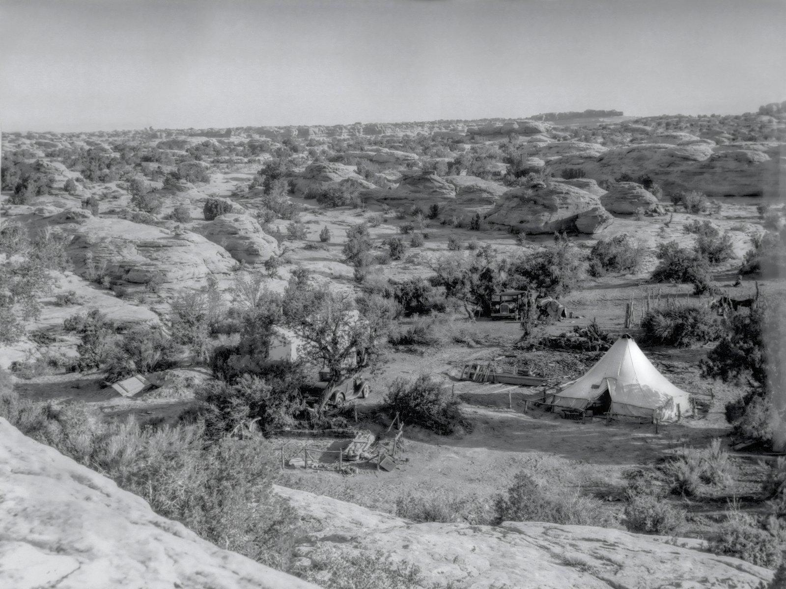
"Director Beckwith has spent his time this month largely in getting
first hand information of the scenic values of the Monument area. On
February 15 (the first date set for the termination of the work),
neither he, J. C. Anderson, or Ralph P. Anderson were ready to hand
in their work; by the first of March Beckwith had finished his work,
retaken 5 by 7 photos in the Arches sector, made other exposures on
smaller film, revisited many points of scenic value in the Arches
sector, and visited the Devil's Garden area twice.
"During the month we were visited by Park Service officials P.P.
Patraw, Harry Langley, and George W'. Norgard. Packer Turnbow, and
Foreman Jack VanYou and J.C. Anderson all assisted Mr. Norgard in
getting as much information on the Monument area as the limited time
at his disposal would allm1. They all took him out on long trips,
requiring much riding and overtime, and the country was studied from
his angle. His visit put a new line of thought into the expedition
which up to that time was thinking in economical terms, with bare
necessities of the first year or second year of tourist travel. Mr.
Norgard saw it in terms of greater development and what was required
to assist that expansion. The expedition feels much benefited by his
change of outlook on the project and now thinks in larger terms,
better roads and more expanded development, to get the fullest out
of the territory.
"The force has been cut down; the laborers, teamster and cook have
been dismissed, and the remaining force consists of Geologist J.C.
Anderson and his helper, to be dismissed as soon as possible;
Engineer Ralph P. Anderson, with two assistants, also to be
dismissed as soon as he has finished field work; the packer, foreman
and Director.
"Archaeologically, Director Beckwith has found nothing in the
Monument area of any note: around Willow Spring some small pottery
sherds, buff material, and one fragment of Black-On-Gray-White,
painted; some few arrowheads, many 'rejects' or chipped flakes; but
in the Monument area no houses nor house remains; no artifacts other
than broken and poor metates, with a fair supply of manos found by
chance. No doubt but that around the water of Willow Spring,
Indians, modern and ancient, visited the spot for summer or winter
hunting, but left no cultural evidences. Archaeologically the area
yields negative results.
"The work of the expedition is fast approaching its termination. The
surveying and mapping should be done now and the remaining time of
the Engineer devoted to working up his notes, drawings, and locating
upon his maps the principal places of interest in the area.
Geologist J. C. , Anderson is nearly through, with what time remains
to be devoted to office work. Director Beckwith is spending his
energies in a thorough study of the scenic and tourist values of the
area, with a view to presentation in terms of tourist appeal.
page 1
REPORT
of Arches National Monument Scientific Expedition
By Frank Beckwith, Director
The purpose of the expedition was divided into three phases, namely
(a) surveying and mapping the Chief points of interest, (b) a
geologic reconnaissance of the area, and (c) archaeological
investigations. Work began on or about December 15, l.933, and was
terminated __________ 1934.
LOCATION: Arches National Monument embraces three areas known as (a)
'The Arches, which in a direct line are situated about eight miles
north of Moab in Grand County, Utah: The Devil's Garden lying in a
long narrow area northwesterly from the Arches, and (c) The Yellow
Cat area northeast of the preceding area. The Arches consist of a
series of sandstone outcroppings, in which aerial erosion has formed
a number of interesting arches in the sandstone, the major ones of
which are described :in the text following; the Devil• s Garden
consists of a long irregular outcropping of sandstone in vertical
slab erosion, presenting pinnacles, domes, and two major arches,
besides a number of smaller ones; the Yellow Cat area differs
radically from the two preceding areas. The interest of the Arches
and of the Devil's Garden consists in the forms of erosion, and the
scenic appeal to tourists; the interest in the Yellow Cat area lies
in the fact that it contains many dinosaur bones. Its scientific
appeal is its chief value, as it lacks the formations and character
of the two other areas.
AUTHORITY AND SET-UP: The authority for the expedition was given by
page 2
the Unit ed States Department of the Interior, National. Park
Service in the following set-up and outline of character of work:
"Arches: 3 unskilled; 5 semi-skilled; 5 skilled; 1 foreman; 1
technician; total 15. $5,171 for labor cost; $800 for other; total :
$5971. Character of work : Archaeological and other scientific
reconnaissance, including the mapping or archaeological situations
within the area; organization of research activities including
clerical service."
The term or work was from December 15, 1933, to
February 15, 1 1934; at that time a continuance was granted, with an
additional appropriation or $3,540.60 for labor, and $150 for other
than labor costs.
ACCESSIBILITY: Highway no. 450 £rem Moab to Thompson is the artery
of travel by which the Arches area of the Monument is reached. On
that road, about eleven miles north of Moab, a temporary road takes
off, 4.8 miles in length to Willow Spring, tho last water toward the
Arches; the remaining distance of about four miles is to be taken
horseback.
The Devil's Garden area may be reached horseback from Willow Spring,
a distance of about five to seven miles to the major arches; or the
trip may be taken by Highway 250 to a point near Valley City
Junction, and turning southeasterly down a poor dirt road which
follows the bottom of Salt Valley to within a distance varying from
one to two miles from the interesting features or that area.
The Yellow Cat area is best reached by auto, turning southward from
Highway 50 at a point about four miles east of Thompson and
proceeding southerly about twelve miles.
Members of the expedition visited each area by pack train, or by
auto, or combined, as was most expeditions.
ARCHAEOLOOICAL INVESTIGATIONS: within the area of the monument,
archaeological investigations conducted over the entire period
yielded
page 3
practically negative results. A few pottery sherds were found near
Willow Springs, mainly black and white decorated pottery; and some
arrow points of flint were recovered, evidencing hunting parties or
slight occupancy by Indians near that source of water.
Archaeological Cave, in the Arches area, had been visited previous
to this expedition and it was reported to us that cedar bark, a few
squash seeds, and some bone awls had been taken from it. Our party
found four pit holes, evidencing visitations by the whites, and
whatever of value the cave might once have held, nothing remained.
Thorough digging was conducted, but yielded no results.
On the pack-train trail from Willow Spring to Yellow Cat, one
"recent" petroglyph was found near Wol£ Cabin; and above it one
figure, more ancient, but Puebloan in design and not Basketmaker.
At Yellow Cat one "recent" group of petroglyphs was found, near a
cattle wallow which contained water after each storm, contiguous to
the monument area, but not within that area.
The Devil's Garden area likewise yielded nothing.
CORRELATIVE ARCHAEOLOOICAL EVIDENCES: North and south of Moab, but
particularly south, the country is rich in archaeological evidence,
of which the bibliography is extensive.
North of Moab, on tho way to the Arches, a small cyst is situated on
the banks of the Colorado River; at the bridge over that river on
Highway 450 a group of interesting petroglyphs my be seen at the
north abutment of · the bridge; and between the bridge and the mouth
of Courthouse Wash is an extensive group of interesting petroglyphs
combined with figures and designs painted upon the rocks; these
include Yebaichi-like figures, long and slender, most. o! which Ar&
painted solidly (not in outline) in a dull red paint, with two large
shields of white. The pecked figures include
page 4
deer, of which an interesting variety is a deer with antlers, and
another deer in a jumping or running attitude, very life-like.
Twelve "moccasin tracks" are pecked in a horizontal strip of rock;
this design has interest in that some of the tracks are side by
side, as if the person represented were standing, interspersed with
single tracks as if the person walked from position to position. One
of the figures pecked is of a round-bellied grotesque animal-like
figure, with a long neck; nature unknown.
The first of these groups may be seen from an auto on the road;
unfortunately it is much mutilated by the whites, who have
superimposed cuttings of their names with cold chisels and painted
names, besides making the group a target for rifle practice. The
second group may be seen from the road dimly, and may be reached by
a short and easy climb.
On the pack-train trail from Moab to the Arches, in Courthouse Wash,
several years ago, a mummy and two skeletons were dug out by
amateurs, which from the best information sifted from a cloud of
rumors seem to have been Navajo remains, not greatly ancient, as the
hair of the mummy was tied in "a Navajo bob" and wrapped with the
white man's red woolen yarn. From best information we are led to
believe that the mummy was taken to Salt Lake City.
These finds give correlative evidence of the occupation of the
Indian near to the territory within the boundaries of the monument,
both since the white man's occupancy and previous to the advent of
the whites.
Tourists to and from the Arches will find much of interest
archaeologically in and immediately around Moab; the best of which
is the
page 5
collection owned by Dr. J.W. Williams, which should be visited and
studied.
SURVEYING AND MAPPING: The surveying and mapping of the monument
areas was undertaken by Ralph P. Anderson, of Price, Utah, whose
work finished and ready is included herewith.
GEOLOGIC RECONNAISSANCE: The geologic reconnaissance was conducted
by J. c. Anderson, a graduate of the geologic department of the
Un1versity or Utah; owing to its importance he was permitted to make
his report separately, signed by himself; it will be sent separately
by him.
SCENIC APPEAL OF ARCHES: The Arches area of the Arches National
Monument has high scenic value. The primary interest is in the
arches themselves, caused by aerial erosion of sandstone, but hot in
any sense stream-worn bridges. These arches vary in size and shape
from very small to the largest. The most beautiful of them all in
this area is
DOUBLE ARCH: The local name for this arch is "The Jug Handles"
because it has a similarity to the component parts of a split jug
handle of which the main handle divides from the part grasped by the
hand, and extends to the edge of the jug in two arches. From one
abutment of massive sandstone, two arches arise, and spanning the
space to the main wall, each merges in the main block of rock at a
different angle. Daylight may be seen through each arch. The
sandstone is a light buff. The span of the larger one of the two
arches is 153 feet, with a height of ll8 feet; this is exceeded by
only one. other arch in the entire area. Persons may clamber to the
floor of the arch with but little difficulty, from which position
beautiful views may be had east and west. Westwardly, in the far
distance, Balanced Rock may be seen, and towers and pinnacles passed
on the trail.
page 6
In the immediate foreground a good example of cross-bedding of
sandstone may be seen in the white underlying sandstone, which forms
the base of the massive buff sandstone above out of which the
erosional forms have been cut. To the eastward the view is
enchanting. The light buff of Arch in the Making, the deeper tones
of Massive Arch and the contrast of light and shadows shown on
Turret Arch, the daylight seen through both of these arches, the
foreground of white rock and dark cedar trees, and the whole
enriched by the view of tho snow-capped distant LA Sal Mountains, of
which Mt. Peale rises to tho majestic height of 13,089 feet, give
this scene a beauty very pleasing.
ARCH IN THE MAKING presents an arch not yet finished; erosion has
proceeded only far enough to slightly separate the arch from the
main wall of the mass or sandstone. This interesting as a study of
the process of arch making.
MASSIVE ARCH is so named because of its massive appearance and the
large tonnage of rock in the abutments and span; its base is bedded
on a sub-stratum which has the appearance of masonry. The span of
tho arch 1s 93 feet and its height 50 feet.
GREAT OVAL ARCH is less massive; hence its span seems to the one
viewing it as greater even than that of Double Arch; its span is ll8
feet, and its height 65 feet. From the floor of this arch much of
the country north and east may be seen, and a distant view of the
country near Yellow Cat may be obtained. Great Oval Arch may be seen
from Wolf Cabin on the pack train trail to Yellow Cat.
TURRET ARCH: This arch is very pleasing, either from a distant view
or seen close. From Highway 450 glimpses of Massive Arch, Great
page 7
Oval Arch and Turret Arch may be caught from the speeding auto. The
height of the arch is 62 feet; width 32 feet. Excellent views may be
obtained of Turret Arch, from either the north, or from chosen
positions to the south. In one view from a southerly position,
through the arch opening of Turret Arch, the Massive Arch may be
seen - an arch within an arch. A small "window" in Turret Arch, and
its turreted abutments make it look somewhat like a medieval
turreted castle.
From Turret Arch the Colorado River is within walking distance to
one accustomed to that form of exercise; from the rim one may see a
bend in the river, presenting the stream both coming and going in
the same field of view.
ELEPHANT AHCH: From Archaeological Cave, two masses of stone
southward present a striking likeness to a cow elephant in feeding
position, with lowered trunk, and her calf ollowing along behind
her.
SALT SPRING: within the area or the monument, in the bed of Salt
Creek, a spring gushes from the wide walls at a height of about ten
to twelve feet, of a very saline character. The water pours into
Salt Creek. By the winding course of the creek, the Colorado River
is about two and a half miles distant.
INTEREST OF DEVIL'S GARDEN AREA: Nearly in the mid-section of tho
long, narrow Devil's Garden area, on the comb outcropping on that
side or Salt Valley, is situated Fallen Rock Arch. This is so named
because a part of the rock mass which fell out still lies in the
corner of the arch, partly blocking it. This. arch is small; it may
be seen from the opposite rim wall on the way from Willow Spring,
and from many po11itiona in Salt
page 8
Valley. It may also be soon from the abandoned cabins at Yellow Cat.
LANDSCAPE ARCH: About a mile or so from Fallen Rock Arch, is seen a
very large arch, the span of which is 291 feet - the greatest span
in the monument area. Through this arch the landscape behind it may
be seen, hence the name. This arch is delicate, as in one place not
many feet of rock are loft. It is not visible from the rock.
DOMES AND PINNACLES: The remaining interest in the Devil• s Garden
area consists of odd, striking and grotesque forms of erosion;
pinnacles, spires and rock masses are presented in confusion. The
sandstone of this area shows vertical slab cleavage; when seen
edgewise, such masses present the appearance of towers and
pinnacles; when seen sidewise, the appearance is of narrow
board-like stone masses with many forms of erosion. In the southeast
tip of Devil's Garden is found the greatest confusion of slab
erosion, presenting a ruggedness and interesting confusion. There
are a few minor arches in the area.
THE YELLOW CAT AREA: Tho interest in the Yellow Cat area lies in its
scientific value as a large deposit of dinosaur bones. The area is
two miles square, containing four sections or land. In this small
area the expedition found about four thousand pounds of dinosaur
bones., consisting of "surface finds"; and in an abandoned mine
shaft, sunk for vanadium ore, we round an embedded bone, which was
partly bared, overlain by massive sandstone. The bone lies in the
thin vein of Vanadium ore. Miners of the region. report many similar
finds as they followed the ore veins. The surface finds were much
weathered, and by now, as each visitor to the area takes a souvenir
bone as a memento or the spot,
page 9
the findings are much sorted over, and the best specimens taken.
Geologist J. C. Anderson round two other embedded bones, but outside
the monument area. He found the area of high scientific appeal, rich
in study, and presenting such a quantity of yields as to rank highly
in scientific importance. His report, submitted with this amplified
outline, gives his findings· in detail, and his conclusions as to
the scientific value er the area.
CORRELATIVE INTEREST
SIDE TRIPS FOR VISITORS TO THE AREAS
Visitors to the Arches National Monument will find it profitable and
interesting to spend a day, or more than a day, in and around Moab;
interesting ancient Indian petroglyphs and pictographs may be seen
by a short auto ride of less than four miles; the first of these arc
situated alongside Highway 450, already described, South of Moab,
two to three miles, part of which distance can be taken by auto,
leaving only about a mile for foot travel, "the Old Indian Fort" can
be seen; down the river from a mile to four miles many large and
interesting groups of petroglyphs may be seen; Indian bones and
pottery have been dug up by persons in the town itself while
excavating cellars; many excellent artifacts of the ancient Indians
have been collected more or less near to Moab, of which the
collection or Dr. J. W. Williams possesses the greatest interest.
Some of the best of his collection are now housed in the University
of Utah at Salt Lake City. Larger journeys from Moab will take one
to cliff dwellings and to much interest archaeologically, as the
country south of Moab is rich in Indian material.
Should one take the horseback trip direct from Moab to the Arches,
page 10
the Towers in Courthouse Draw present some striking scenery. On the
way one passes petroglyphs alongside the bridge, and those alongside
Highway 450; where the Navajo mummy was found may be pointed out by
the guide.
If the auto trip to the Arches is taken, dinosaur bones were found
almost within hailing distance of the road where it crosses
Courthouse Wash, a mile and a half from Highway 450; a petrified
tree ten to twelve feet in the unbroken section, and about sixteen
to eighteen feet long including the broken piece lying near, may be
seen less than a half mile off the road, almost directly south or
where the road crosses Courthouse Wash; small pottery sherds and
many arrowheads found. at Willow Spring. Miniature Arch is about a
half mile distant.
From Willow Spring it is necessary to ride horseback to the Arches;
on the way one passes the Bee Hive a large button of sandstone, worn
by aerial erosion to the form of a bee hive, and enhanced by
numerous pits in bands, much resembling a bee hive, the state emblem
of Utah. A massive but small arch may be seen a few hundred yards
farther on; around the corner of that outcrop a small arch may be
seen high up, near the top of the sandstone mass.
By riding near the rim or Salt Valley, a view of "the miniature
painted desert" may be seen, and the small area of typical "bad
lands" there presented. In the rich, dark brown beds of shale found
there, fossil molluscs may be picked up (Gryphaea. newberri Stanton)
in the base of the Mancos shale.
When nearly to the arches, a. sandstone layer presents some very
good specimens of ripple marks. This is on one of the main trails
which leads past the Balanced Hock.
To those who still look upon pack train trips with interest, the
trail
page 11
from Willow Spring to Yellow Cat presents some very interesting
things. A detour of half a mile from Wolf Cabin takes one to the
fossil molluscs named above; a detour of half a mile west takes one
to a deposit of dinosaur bones on the crest of a divide. The largest
bone of this find is about eleven inches in diameter and weighs
(estimated) about sixty to seventy pounds. A detour of a half mile
east takes one to a very fine deposit of dinosaur bones, where the
animal was found partly exposed and weathered, and partly embedded
in the red beds there resting shallowly on much uptilted sandstone.
The animal lay partly on its back, and digging uncovered the
isachium and pubic bones of the pelvis, and eleven tail vertebrae,
the largest of which is about thirteen inches in diameter; two or
these contra were placed in the cure of the Custodian of the
monument, and are on exhibition at the Times-Independent office in
Moab, and attract a great deal of local interest. About a hundred
yards further two very large fragments were found, one of a part of
a femur and the other of an unidentified bone, which specimens were
placed in charge of the custodian and left in situ for tourists
taking that trip.
From a position slightly further north and a little more than half a
mile from Wolf Cabin, Delicate Arch may be seen., which has rare
beauty. Both these detours to the east from the pack train trail can
be taken on one trip, with the total distance covered going am
coming from the main pack train trail of slightly more than a mile.
From Willow Spring to Yellow Cat by pack train trail is about
fifteen miles; with the east detour included, the trip can be nicely
made in one day. To those who see the romance in the
fast-disappearing cowboy, the slow-plodding pack animals, and the
"back to nature" means of transportation
page12
this trip will be of major 1nterest. Delicate Arch has rare beauty,
and is striking]y presented, dominating the field of view.
The guide can take one to the petrified tree, of which an unbroken
length of about twenty feet is uncovered, a short distance from
Delicate ·
The pack train trip to Yellow Cat passes up a narrow and deep wash,
with high ledges of sandstone on either side, fantastically eroded,
with spires, twin spires, towers, and caves to interest. As the head
of the wash is reached the terrain of Yellow Cat comes to view -
horizontal strata, interspersed with narrow bands and ledges of
sandstone, with Morrison shale formation bearing the deposits of
dinosaur bones.
By auto the trip from Willow Spring to Yellow Cat is about forty
miles. Highway 50 ( Grand Junction to Price) is twelve miles
distant.
SUMMARY
The monument area embraces three divisions:
The
Arches - Value scenic
The Devil's Garden - Value scenic
Yellow Cat -
Value scientific
Respectfully submitted,
(Signed) Frank Beckwith
Director
Contact info:
This website is copyright 1998-2025 by Mike McCue Moab Utah USA